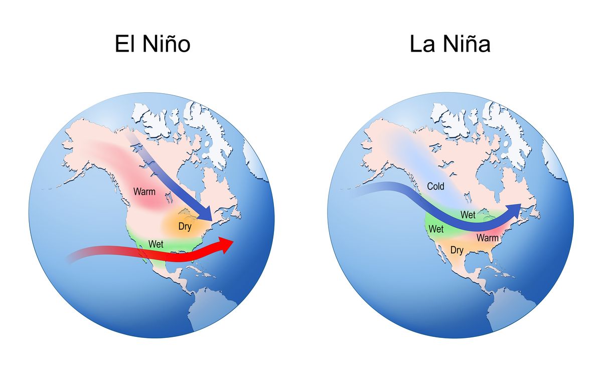
El Niño is characterised by warmer surface waters of the central and eastern Pacific, which causes changes in global weather patterns and the rarer ‘super El Niño’ is expected this year
Experts are warning of a rarer natural climate phenomenon developing this year, raising the global temperatures and potentially bringing extremely erratic weather to the UK.
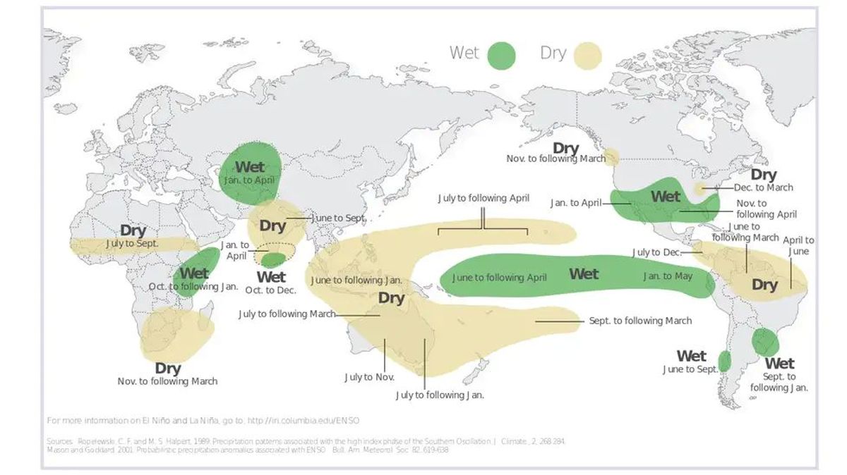
El Niño is a natural climate phenomenon. It is characterised by warmer surface waters of the central and eastern Pacific, which causes changes in global weather patterns.
This occurs when the temperature rise is at least 0.5 degrees Celsius above average across the central and eastern equatorial Pacific.
AccuWeather Long-Range Forecaster Paul Pastelok said that El Niño itself is not a single storm, but a large-scale climate driver that can tilt the odds toward certain weather patterns.
READ MORE: UK weather maps show Brits to bask in glorious mini-heatwave — see 8 hottest citiesREAD MORE: Exactly how often you should mow your lawn from now until October“An El Niño is not a storm. It does not affect you directly. It is a cycle that contributes like many other factors to produce weather changes and sometimes extremes,” he said.
The El Niño phenomenon moves in cycles with its opposite La Niña. There have been 27 El Niños since 1950, with one happening on average every 3 to 4 years, The Weather Channel reported.
Experts have warned that a super El Niño is increasingly possible later this year. This is may have significant global impacts on rainfall and temperatures from summer through winter.
The National Oceanic and Atmospheric Administration has assigned a 25 percent chance El Niño could intensify into a super El Niño by fall or early winter.
A super El Niño occurs when warm ocean anomalies reach at least 2 degrees Celsius.
These intense El Niños are more rare, with only five since 1950. The last super last El Niños occurred 11 years ago from 2015-16.
Every El Niño is different, The Weather Channel reported, but generally, the stronger the El Niño, the more likely its typical impacts on global weather will happen.
Potential impacts of a stronger El Niño include:
- More sinking air and stronger wind shear in parts of the Atlantic Basin, both hostile to hurricanes
- In winter, the southern branch of the jet stream usually is turbocharged
- Parts of Africa, India, Australia, the Philippines, Indonesia, the Caribbean and northern South America are generally markedly drier
- A spike in global temperatures is likely
A stronger El Niño can also raise the risk of impactful storms later in the year. For the UK, this may mean anything from unseasonably warm spells to periods of heavy rainfall. It can also influence storm tracks across the Atlantic, potentially affecting how and where winter storms develop, according to The Standard.
The global temperature signal tied to El Niño may not peak immediately. While the pattern is expected to develop this year, the highest global temperatures linked to it would more likely occur in 2027 rather than 2026.
While uncertainty remains in just how strong the event ultimately becomes, confidence is increasing that El Niño will take hold.
“We will likely see at least a moderate El Niño, but more likely a strong El Niño,” said AccuWeather Senior Meteorologist Chad Merrill.
Source link