
UK weather maps forecast temperatures to soar into the low 20s this week, with five regions set to hit 22C after Storm Dave clears
UK weather maps are predicting a return to warm temperatures in the coming days, with five regions expected to reach a sweltering 22C.
The milder conditions forecast for midweek follow a spell of unsettled and disruptive weather caused by Storm Dave, which has delivered heavy rainfall and powerful winds.
However, a shift in the jet stream later this week will enable high pressure to develop from the south, bringing a temporary yet significant change in conditions.
As Storm Dave moves eastwards, warmer air from continental Europe will sweep into southern Britain, pushing temperatures up into the low 20s.
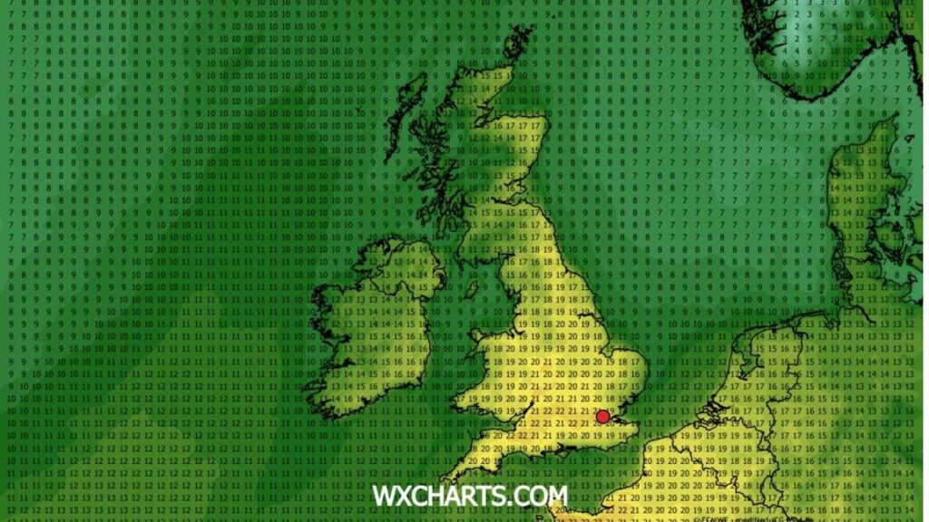
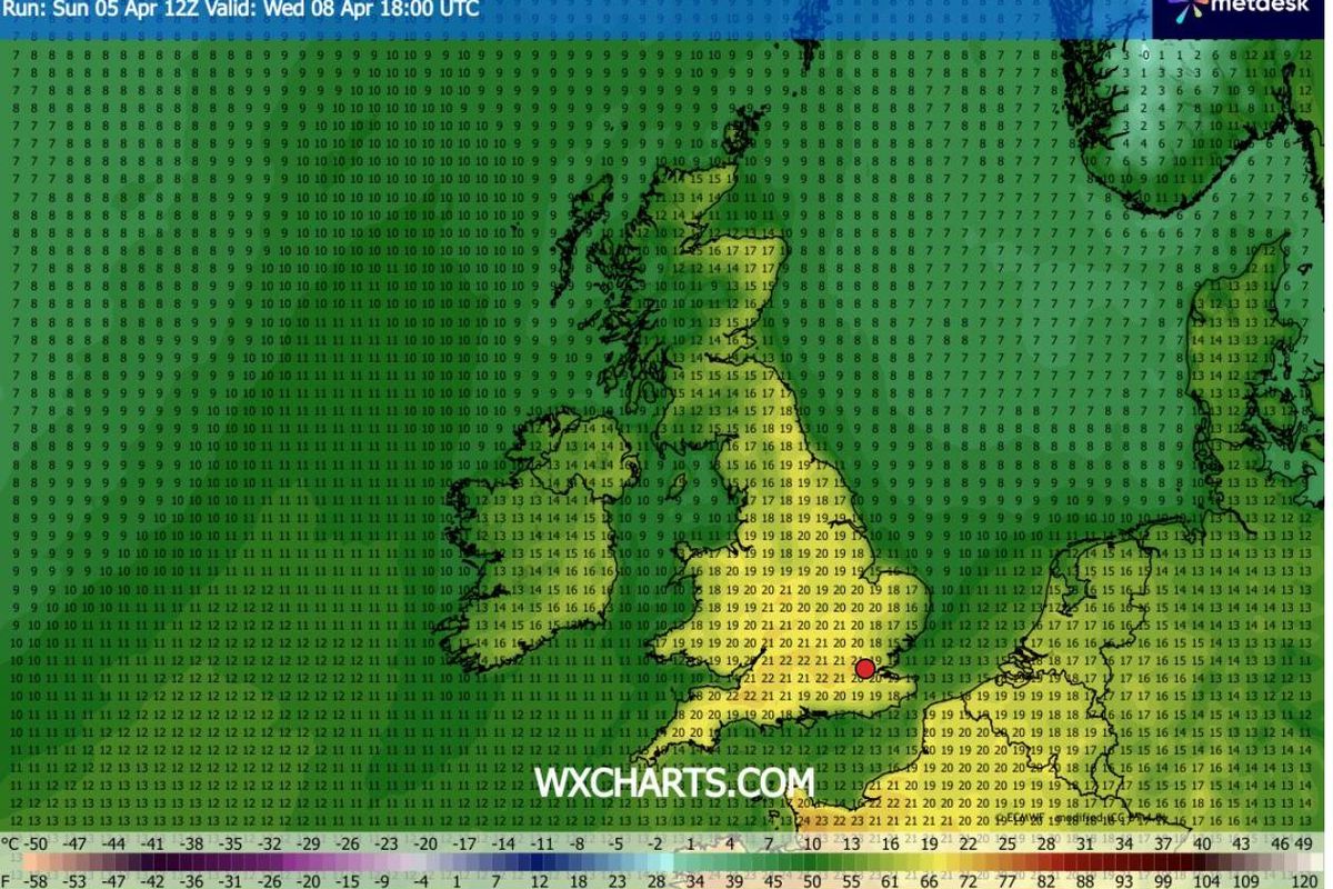
According to WXCharts weather maps, using MetDesk data, areas of the South East will reach 22C on Wednesday, April 8, while vast stretches of England will experience 21C.
Additional maps indicate many parts of the UK enjoying highs of up to 19C from Tuesday, though the peak of the scorching temperatures will arrive on Wednesday at around 6pm.
All regions that are forecast for 22C
- London
- Kent
- Essex
- East Sussex
- Thames Valley
All regions that are forecast for 21C
- Midlands (West & East Midlands)
- East Anglia (Norfolk, Suffolk)
- Lincolnshire
- Gloucestershire
- South Wales
And numerous other parts of the UK will experience temperatures exceeding 20C, according to the maps.
It will provide a welcome respite for many, following the Met Office’s warning that Storm Dave could deliver heavy snow and gale-force winds on Sunday.
An amber weather warning for wind was implemented for areas of northern England, Scotland and Wales earlier on Saturday, and the Met Office has now stated the storm will “continue to deepen”. Fierce blizzards and powerful gale-force winds are already causing havoc, with gusts of up to 66mph recorded in Capel Curig, north Wales.
Areas of Lancashire, North Yorkshire, Northumberland, north Wales and Scotland fall under the amber warning, which came into force at 7pm and is set to remain in place until 3am on Sunday.
A separate wind alert covering northern England, parts of Scotland and areas of Wales remains active until 7am on Sunday.
Source link